
Maps
Plan of the Town of Boylston - March 1795
Includes locations of roads, rivers, ponds, Second Meeting House, & town boundaries
by Aaron Sawyer, Jr.
Plan of the Town of Boylston -1830
Survey according to an Act of the General Court March 1830
Depicts locations of roads, rivers, ponds, brickyard, saw mills,
Second Meeting House, Historic Town Hall & School Building, East School, South School, Town Pound
by G. Smith
Sawyers Mills Map -1855
Includes landowners
Plan by Clinton Company
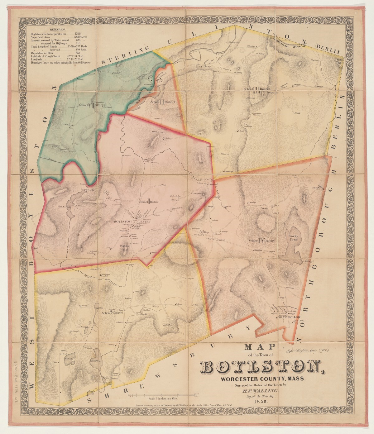
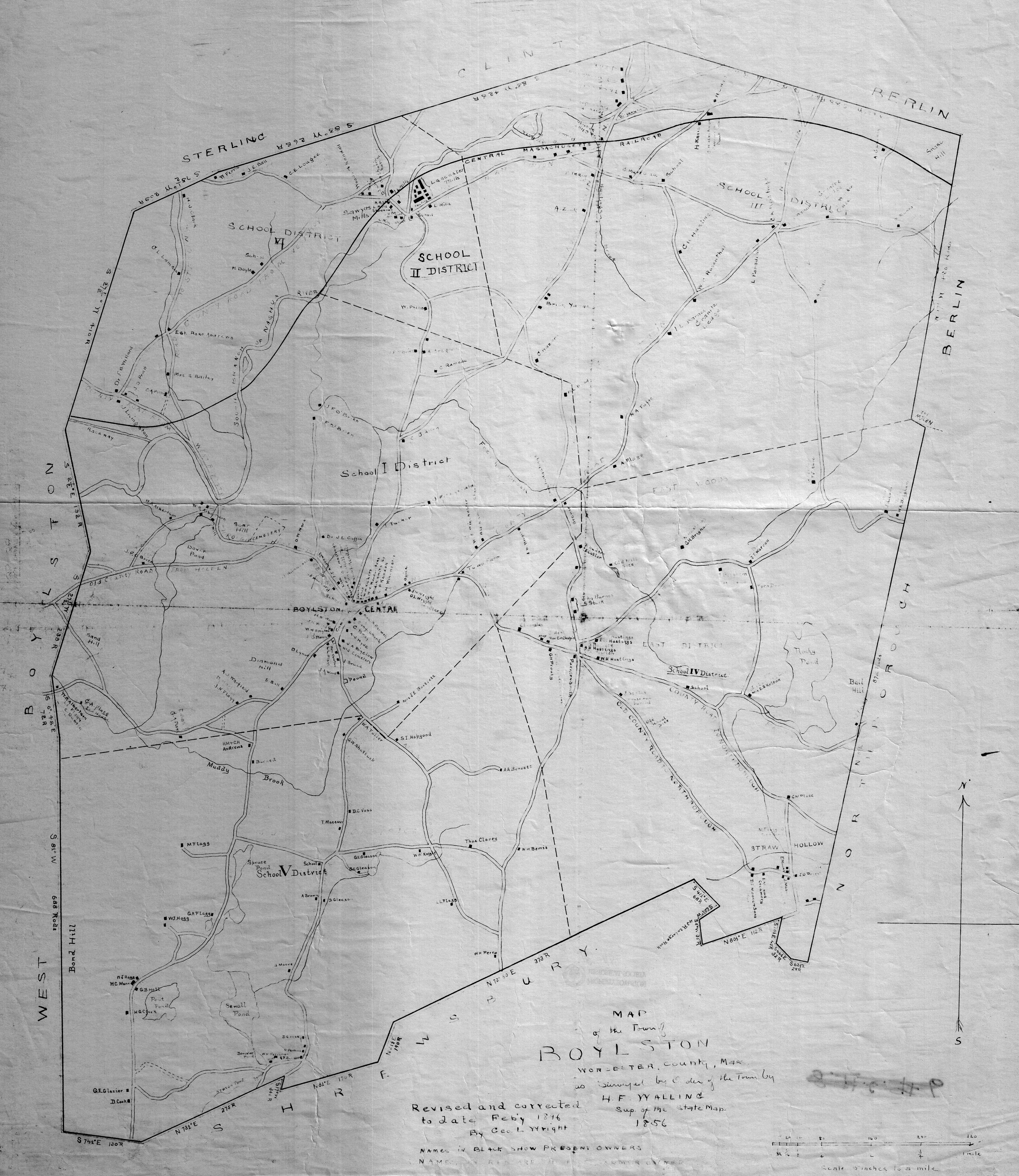
Map of Boylston, Massachusetts - 1856 revised in 1896
Revised and corrected to February 1896 by George L. Wright, Town Clerk
Includes landowners
Something About Maps
Includes Boylston Maps, 1850, 1870, 1900 (partial)
by Carrie Crane
~~~~~~~
Hillside Nature Trail Network & Demonstration Forest
Access points @ Elmwood Place or 221 Main Street, Boylston, Massachusetts
Includes National Historic Landmark, forest, bog, vernal pool, pond,
Civil War Memorial, & Historically Significant Buildings from the early 1800's
Summer Star Wildlife Santuary Trail Map
Access point @ 690 Linden Street, Boylston, Massachusetts
Diverse forest canopy with footpaths winding through woodland, wetland, and beaver pond
Natural surrounding of forest, brooks and wildlife